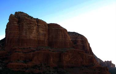
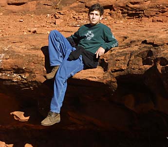
We all discovered our inner rock climber, and aside from a few scraped knees and bruised egos, we had a perfectly wonderful time. Several of us actually made it to the very base of the upper spires, above which is only accessible with heavy-duty rock climbing gear. The views from that high are magnificent, and although we lack any empirical evidence, we can vouch this particular "Power Vortex" as being well worth the effort!
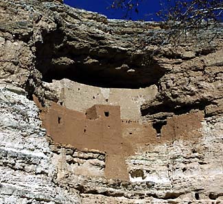
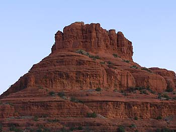
Here is Max and his friend Stuart "Rainman" Zall, and a view of Montezuma's Castle from below. It's an inspiring sight, if not a little abstract for the younger kids because it's something like 80 feet off the ground, and completely inaccessible for the general public. Again, we managed to entertain ourselves in a big way, and it was quite enjoyable.
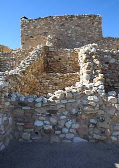
Next, we drove about a half-hour away to Tuzigoot, a whimsically-named Indian (well, that's what they call themselves!) settlement that sits majestically atop a small hill in the middle of the Verde Valley ("Green Valley" in Spanish).
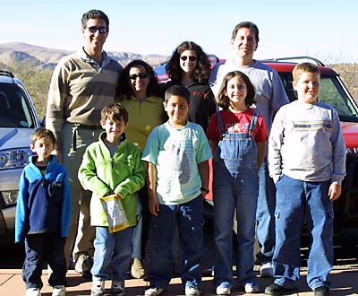
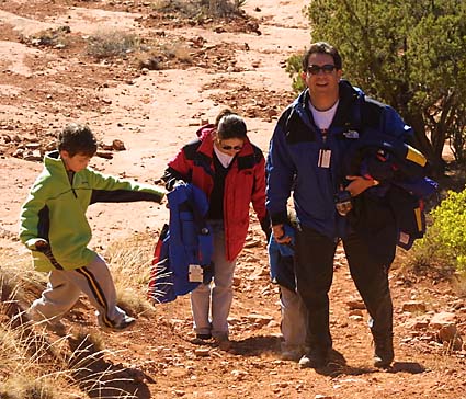
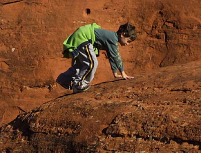
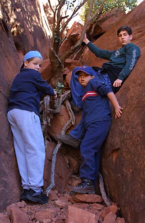
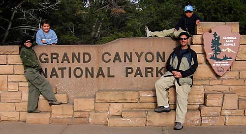
The ruins were way more fun for the kids, giving them ample opportunity to hide from their parents. Unfortunately, their parents were way too embroiled in grownup conversations to care, and the kids ended up just hanging out with us after all. Finally, just before heading off in opposite directions, we all posed for one last photo together with our trusty vehicles.
The Mallers were now off on their own, and decided to be a little intrepid. We spotted a small mining town called Jerome on the GPS, and we plotted a course for it. It turned out to be one large, somewhat overblown outdoor shopping mall with about 200 art galleries (about one for every inhabitant of the town) and a goodly number of tourists. We cruised through town, and decided to press on. By then it was getting late in the afternoon, and we wanted to try and get to the Grand Canyon near nightfall.
The Garmin Streetpilot III GPS hadn't failed us yet, so we once again entrusted our fate to it, and laid in a course direct to the Yavapai Lodge in the Grand Canyon. Interestingly enough, the result was a route that had only three turns in 124 miles. Curious, we headed out. Almost immediately we hit upon a stretch of gravel road, and it climbed rather dramatically out of Jerome (which was at 5,000 foot altitude already).
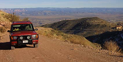
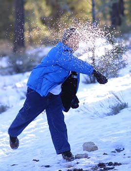
Here we are far above Jerome and Tuzigoot, looking very much like our beloved "Chobe" was auditioning for a Land Rover advert! We continued to climb, and before long, found ourselves above 7,000 feet...far above the snow level.
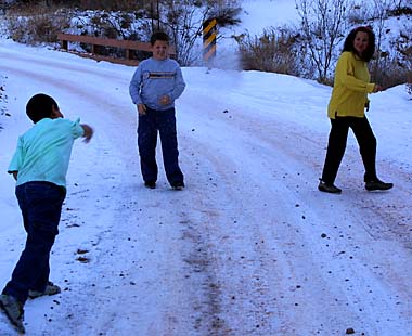
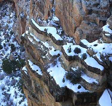
It was way too delicious to pass up this opportunity, and we all stepped out into our private winter wonderland to engage in a brief snowball contest.
Little did we know, but this gravel stretch of road would continue for over 27 miles, testing our Rover, our endurance and our kidneys. All passed with flying colors. After an hour of nostalgia from our African Safaris and their offroad adventures, we finally found blacktop again. After a brief intersection with the famous "Route 66" in Williams, we continued north towards the Grand Canyon. We arrived just after sunset, tired, but looking forward to our next adventures!
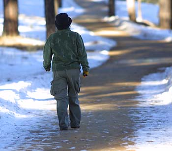
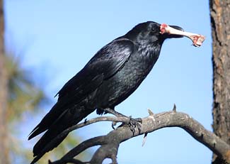
Once done, we grabbed the rest of our gear and headed out. We got a little lost, as our trusty GPS is somewhat inefficient for walking. But after a nice half-hour walk through the woods (where we ran across a Raven with his breakfast), we eventually made it to the Canyon Rim.
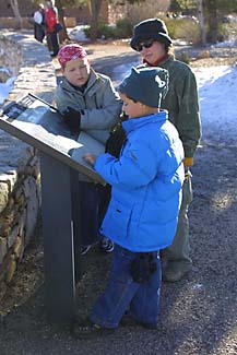
Sam proudly read some of the posted notes to us along the rim.
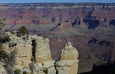
We walked about two miles total, enjoying periodic stops to see the views and the angles and the sunlight gradually changed.
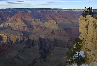
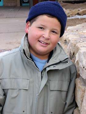
Although barely visible in this view (sorry for the low resolution photos!), you may be able to make out Doreen, Max and Sam (in his blue jacket) on the overlook at Mather Point.
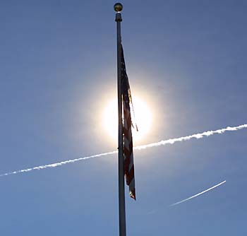
Steve thinks this photo is something of an homage to the heroes of September 11th.
As the day wore on (and we wore out!), we decided to take the Rover for a ride to the west along the canyon rim, stopping at several observation points along the way. The sunset was magnificent, and we would have included photos of it, but Steve forgot his tripod, and is too much of a fussbudget perfectionist to include the couple of rather unimpressive examples he got.
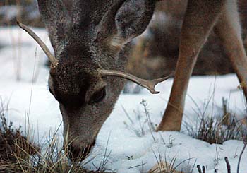
However, on the way back to the lodge, we came across a family of Mule Deer feeding along the road, and despite the fading twilight, we did get a couple shots of them. This one was particularly homely with his mismatched set of vestigial horns. It seems adolescence can be unkind to species other than homo sapiens, too.
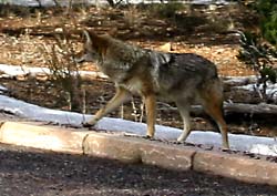
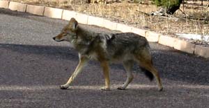
Just when we thought our "down" day was going to be completely uneventful, we had an African safari moment when we spotted a pair of Coyotes along the side of one of the roads. We stopped to photograph them as one was looking to cross the road.
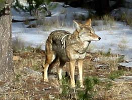
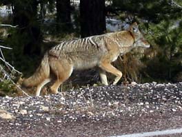
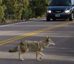
And no sooner did the one on the right cross the road, his partner did, too. Beautiful beasts, these are, with their mottled coats, sleek faces, and beautiful bushy tails...
We bid farewell to the grandeur of the Grand Canyon, and headed on a circuitous route to Zion National Park.
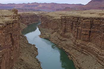
We crossed the mighty Colorado River, an inspiring sight.
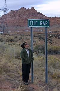
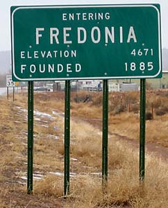
Along our winding route, we passed a couple of notable small Arizona towns. The first, "The Gap", was a tiny town with little more than an Indian curio stand and a bar. The second is the answer to a Marx Brothers trivia question. The nation of Fredonia is featured in the classic movie "Duck Soup".
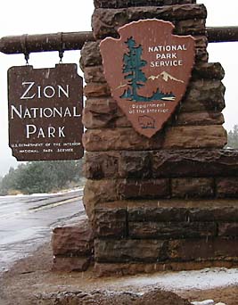
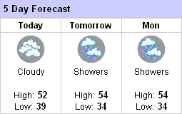
After almost five hours of driving, we finally reached Zion. It was snowing! At this point, we are debating whether or not to stay at Zion. As you can see by the weather forecast for neaby St. George, it is looking a little bleak!
Stay tuned for the next exciting episode of the Maller's travel adventure. Will it be called "Hiking and Shivering in Snowy Zion"? "A Weather Miracle in Utah"? Or, maybe "The Mallers Head To Death Valley"? You won't know unless you check back!